
The North Cascade Highway( AKA Highway 20) here in Wa. is the northernmost route West-East through the Cascade range. It closes every winter as the snowload is simply too much to keep clear. Every spring crews blast open the road again, it's become a bit of a rite of spring to ride it asap. It's one of my favourite roads, combines amazing scenery, perfect pavement, twists and turns interspersed with wide open areas, and relatively little traffic.
I watch their website Here
to find out when they've opened, it's also neat to peruse the pics and history of the highway.
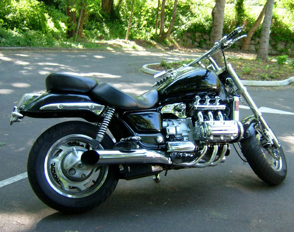
I bolted the backrest onto my custom Honda Valkyrie, as my wife Denise had expressed an interest in accompanying me. She took the vast majority of the pics here, by the way.Click on them to make them big.
I watch their website Here
to find out when they've opened, it's also neat to peruse the pics and history of the highway.
I bolted the backrest onto my custom Honda Valkyrie, as my wife Denise had expressed an interest in accompanying me. She took the vast majority of the pics here, by the way.Click on them to make them big.
It was a beautiful sunny day, yet I knew we'd be in the mountains, so we bundled up in our magical heated gear by Gerbing. Having a warm body makes the experience so much more enjoyable.
We set out from Seattle, cruising through the sunday traffic on I-5. Turned off and headed toward the tiny lumber town of Darrington, in the foothills of the Cascades.
We set out from Seattle, cruising through the sunday traffic on I-5. Turned off and headed toward the tiny lumber town of Darrington, in the foothills of the Cascades.


Nice mini glacier as you enter the town limits. The peaks begin to appear in the distance as you wind closer.
Stopped for a break at this interesting little shop. They grow their own stuff here, all organic, you can wander through the gardens out back as you eat whatever little delicacy you've chosen from the display. We had homemade ice cream with blueberries grown right here, and I bought a bit of candied ginger root for the road.
Stopped for a break at this interesting little shop. They grow their own stuff here, all organic, you can wander through the gardens out back as you eat whatever little delicacy you've chosen from the display. We had homemade ice cream with blueberries grown right here, and I bought a bit of candied ginger root for the road.

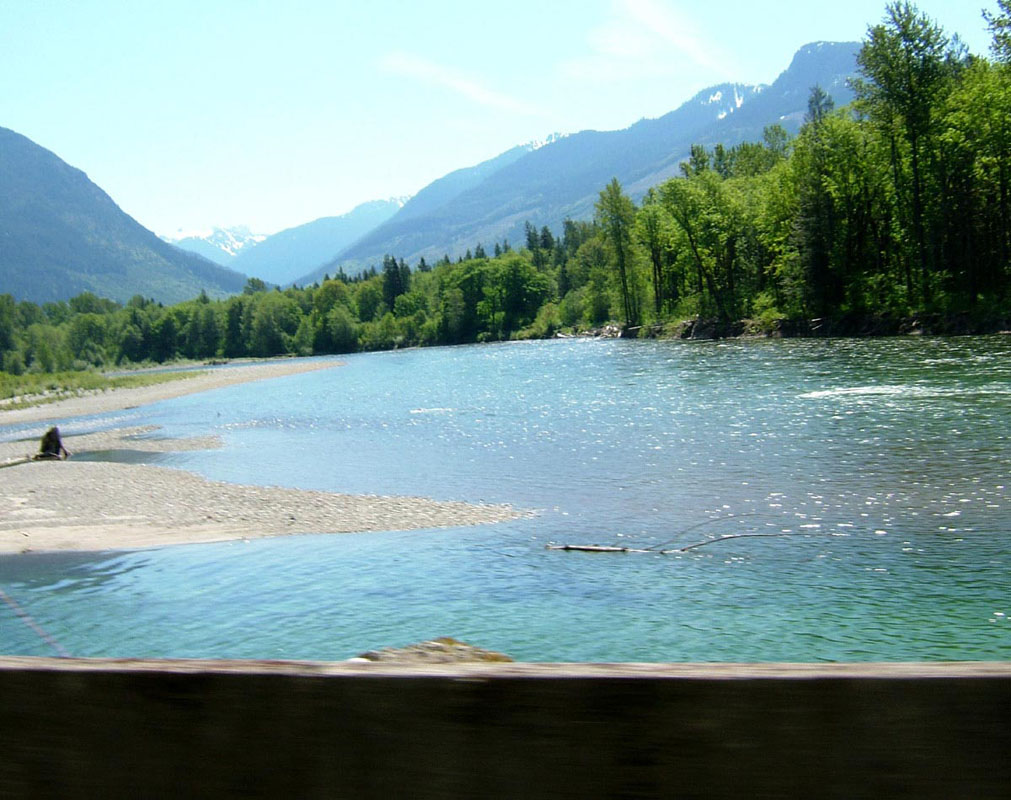
Started rolling again, the road becomes what I think of as classic foothills... tall trees lining both sides of the highway, competing for the abbreviated light, and rough rivers, either swollen and green with runoff or wide gravel bars with small rivulets. The temp drops significantly as you cross these little streams, a reminder of the water's origin far above.

The road begins to turn more, starts snaking up the flanks of the hills. Nothing severe, just gradually beginning to climb. Short tunnels start to appear, designers taking the "straightest-line" theory.

These tunnels now have "lit" center line indicators, I like it.

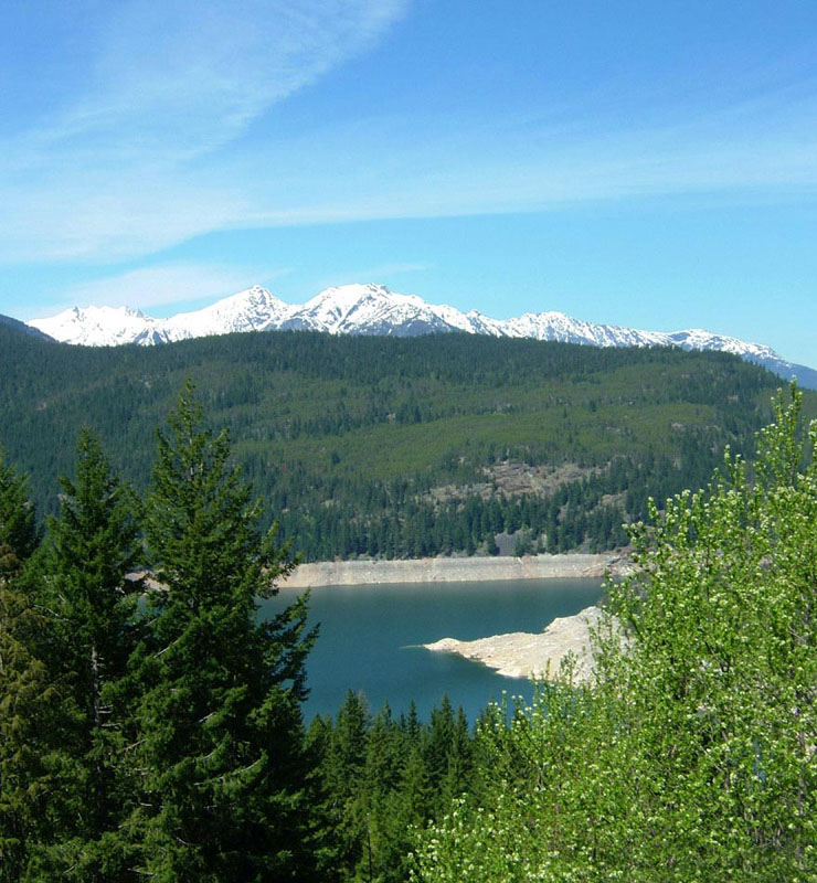
We continue to climb, following the sides of a valley

carved by the drainage of Ross and Diablo Lakes, now dammed.
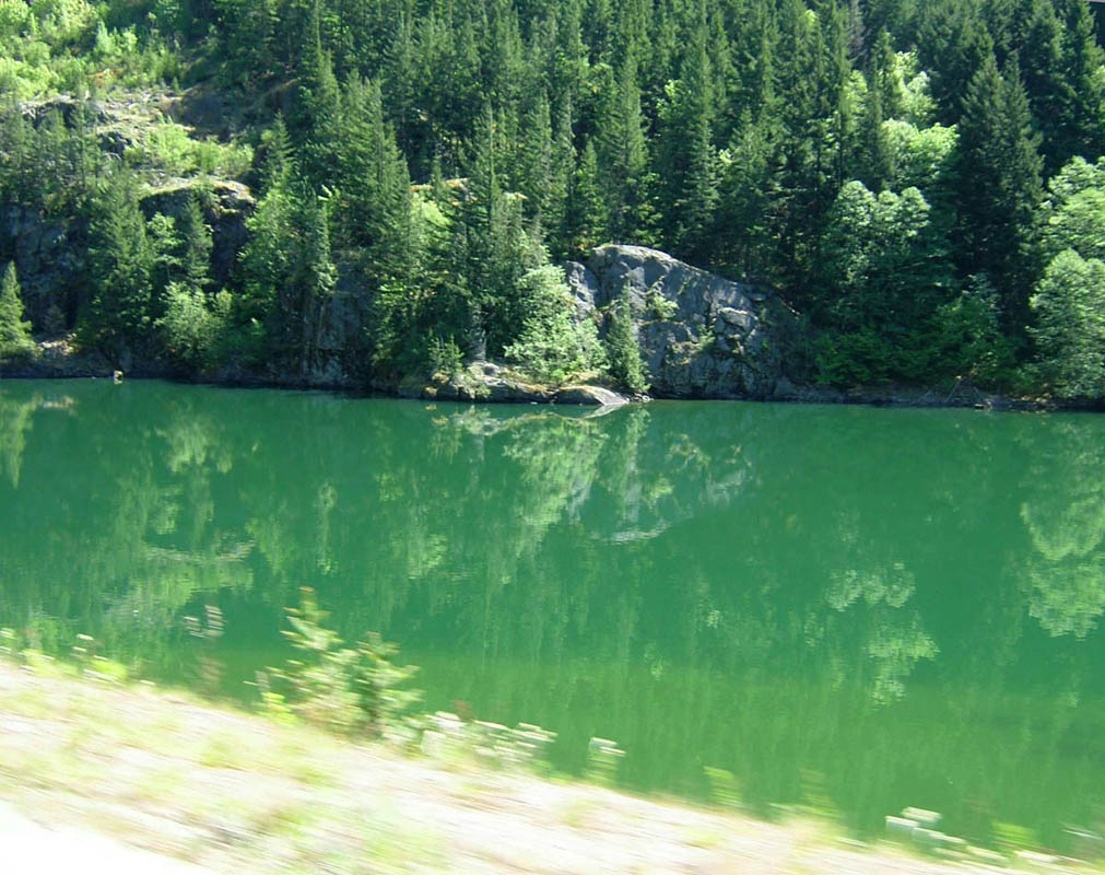
The glacial runoff is a brilliant green from the silt suspended, the nearby "town" of Diablo runs kayak/raft tours here.Center of this pic is a raft.

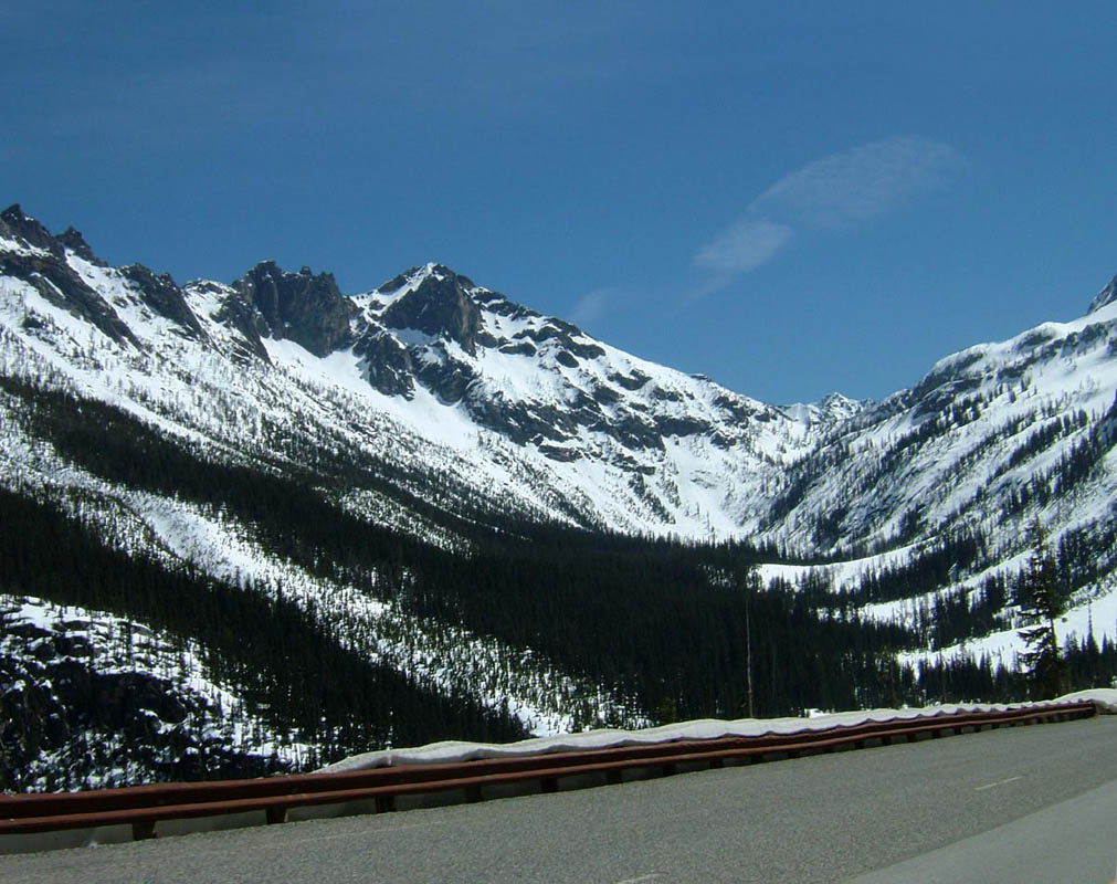
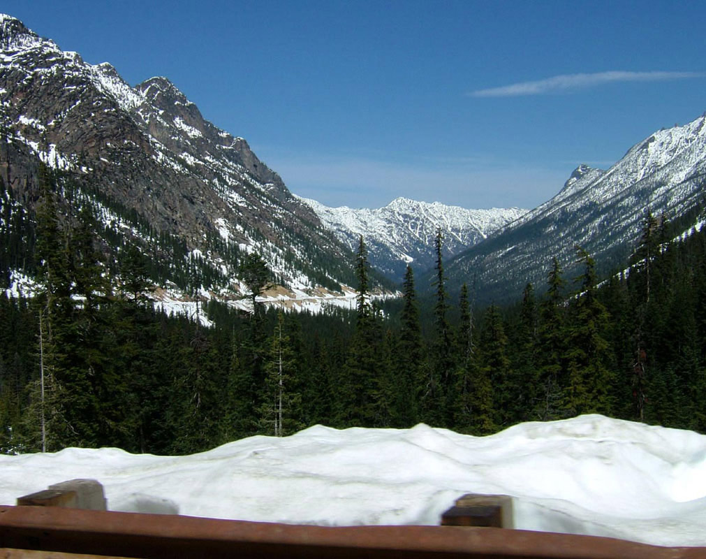
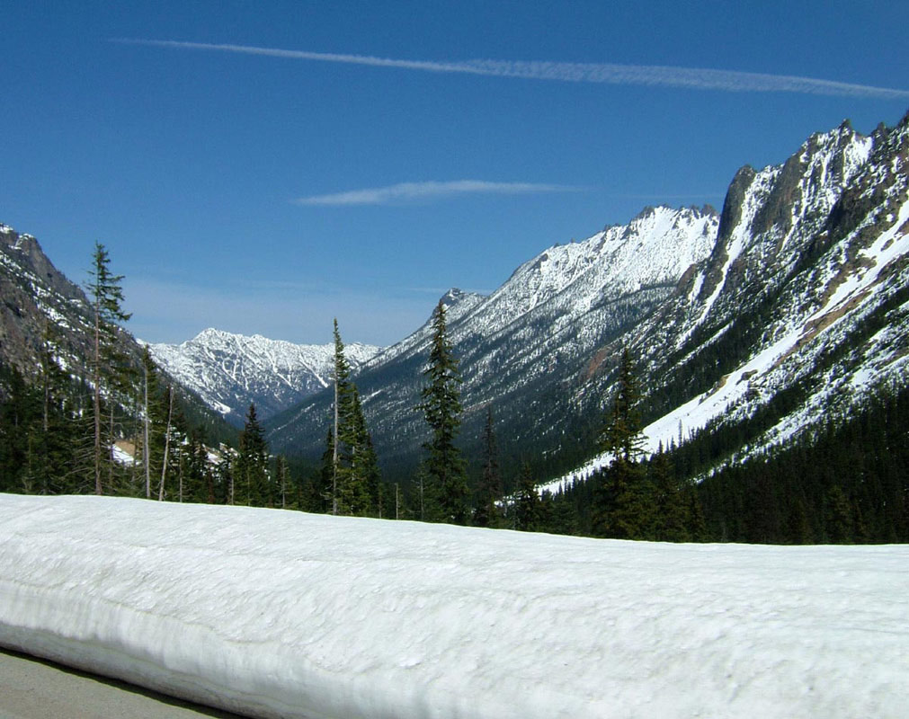
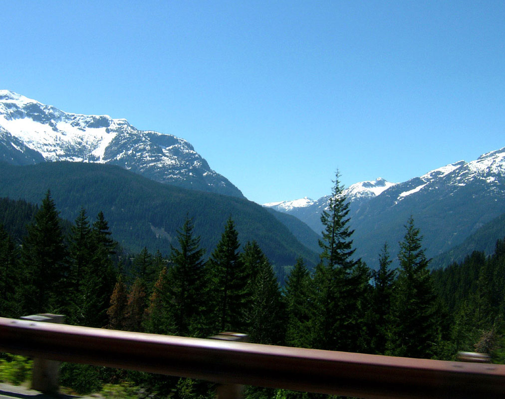
Snow covered mountaintops begin to appear as we continue to climb. I'd assumed we'd need our heat, but it truly was a beautiful day and the simple windstop/layer the heated gear provided was enough.


Over the top, Rainy Pass, and down into the other side. 45 feet of snow greeted highway workers here a few weeks ago, as this is the lee side, avalanches are common and the road switchbacks up the steep slope.


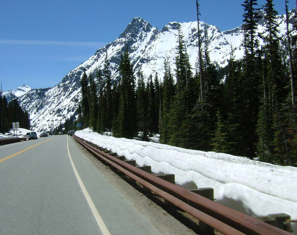
We turned around after running down the flanks of the back side, when the road stopped it's contour hugging and became a boring straight shot to the next tiny town. Coming back was just as fun, different sights as you get to come back down the anfractuous valley.
Ross Lake was low on water, with much of the shoreline exposed. Not for long, though, there were many rivulets of water running across the road from the snowmelt.
Ross Lake was low on water, with much of the shoreline exposed. Not for long, though, there were many rivulets of water running across the road from the snowmelt.


What a great day.
posted by Cyemm at 11:35 AM
![]()
![]()


0 Comments:
Post a Comment
<< Home